WEST COAST INTERIOR BICYCLE ROUTE
The West Coast Interior Bicycle Route (WCIBR) is a 2,118 mile DIRT alternative to the classic Pacific Coast Highway (PCH) bike route. It follows various premade routes on BIKEPACKING.com while filling in the gaps with various rail trails, dirt roads, and national forests. Experience the mountains, forests, coast and desert (alternative) in one epic ride.
(I rode this in 2018 and haven’t since but left a review of someone who did half of it 2023 at the bottom)
The WCIBR starts in the interior of the Pacific Northwest, as you ride south from the lush greenery of Washington to the Columbia River Gorge, it quickly transitions into the wild west of Oregon passing through rural farmlands on dusty trails reaching the end of the Southern Cascades. Skirting alongside the Sierras you can either head west on the infamous Pacific Coast Highway along the Pacific with its breathtaking sunsets and coastal descents or continue onwards along the San Gabriel mountains north of LA.
The WCIBR is a blend of backcountry riding to road bicycle touring with the Adventure Cycling Pacific Highway as a bailout / alternative once you hit Northern California. Resources can be limited in certain sections so riders should be prepared with enough food and water.
Stats:
60% Dirt!
Rideable time: 98%
Total Ascent: 178,647’
Highest Point: 6748’
Routes followed:
–Washington: Boyz on the Hoods route (Seattle start)
Alternative: Ride the Columbia Ramble (Eastern WA, following the Columbia River)
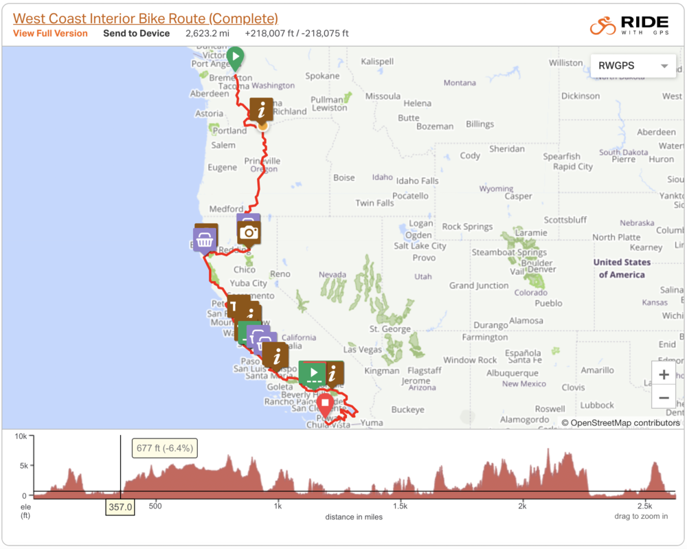
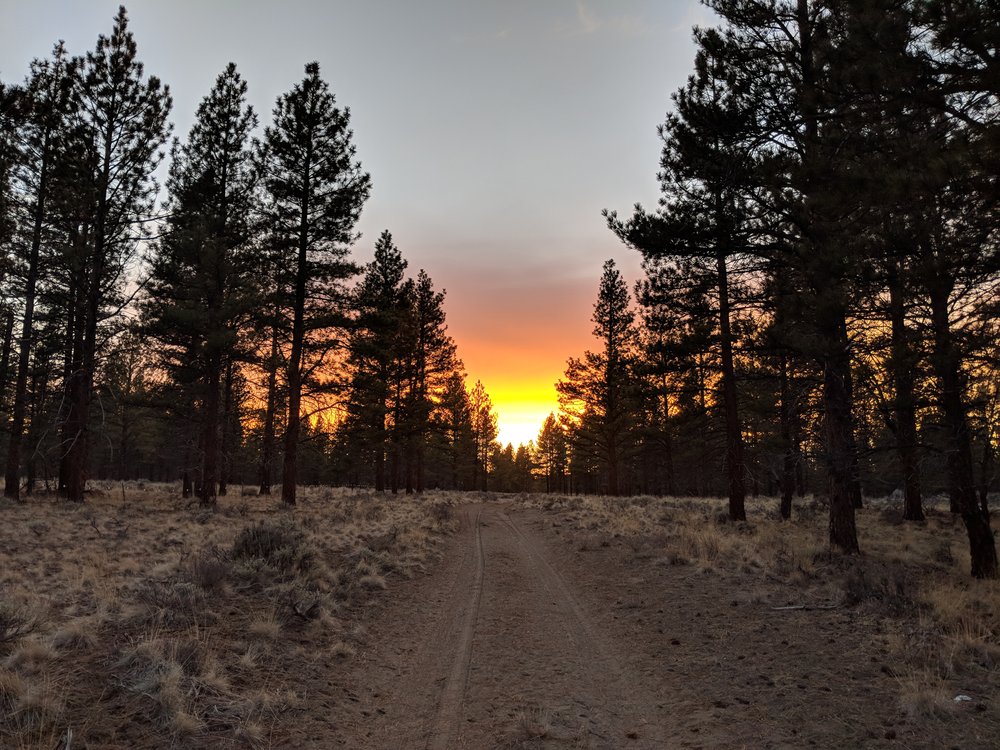
–Oregon: Oregon Outback Trail
–California: Pacific Coast Highway, Northern California Loop, Central California Wildflower, SF Peninsula Traverse, Marin Mountain Bike Trails, Lost Coast Ridge Trail, Tour de Los Padres, San Gabriel River Trail
-Route Alternatives: Washington Backcountry Discovery Route (https://ridebdr.com/WABDR), Baldy Bruiser and SoCal Desert Ramble
**As an alternative, you can continue from LA to San Diego following the Baldy Bruiser & SoCal Desert Ramble on bikepacking.com**
Route Development:
Laying in my van in Bishop, a rock climbing mecca in the heart of the Sierras, I was antsy. Tired of dirtbagging and paying for gas, I decided last minute to bike the West Coast on as much dirt and backroads as possible. The problem was there wasn’t a route online so over the next three days, I spent two days mapping the WCIBR in my van. Next, I drove to LA to store my van then flew to Seattle to start my journey.
This wouldn’t have been possible without the routes listed above from bikepacking.com and other websites. Thank you to those who have spent time publishing their own routes!
Highlights:
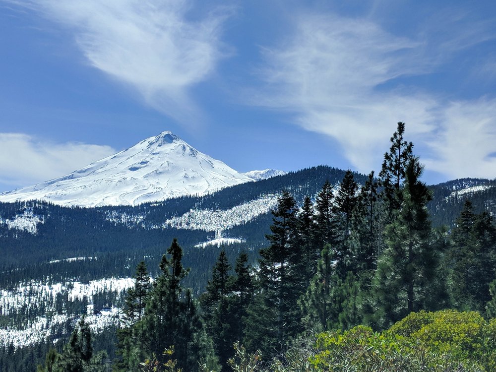
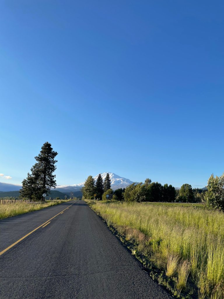
-Epic views of Mt. Shasta and Mt. Adams
-10 U.S. National Forests throughout Washington, Oregon, and California
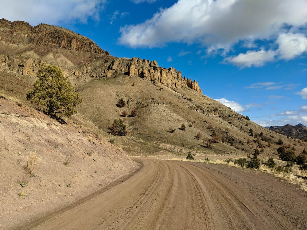
-The Lost Coast, your introduction to the Pacific Ocean via the Lost Coast Ridge Trail
-Redwood forests of California via Avenue of the Giants
-Vast farmlands of rural America via the Outback Oregon Trail in Eastern Oregon
-Big Sur riding on Coast Ridge Road. Mountains on the west and Ocean on the east
-Klamath National Wildlife Refuge, birds for days!
Timing:
I would suggest late spring, early summer for southbound riders. Early-mid spring for those who are riding northbound and want to incorporate the Baldy Bruiser/SoCal Desert routes to connected with the WCIBR.
Gear:
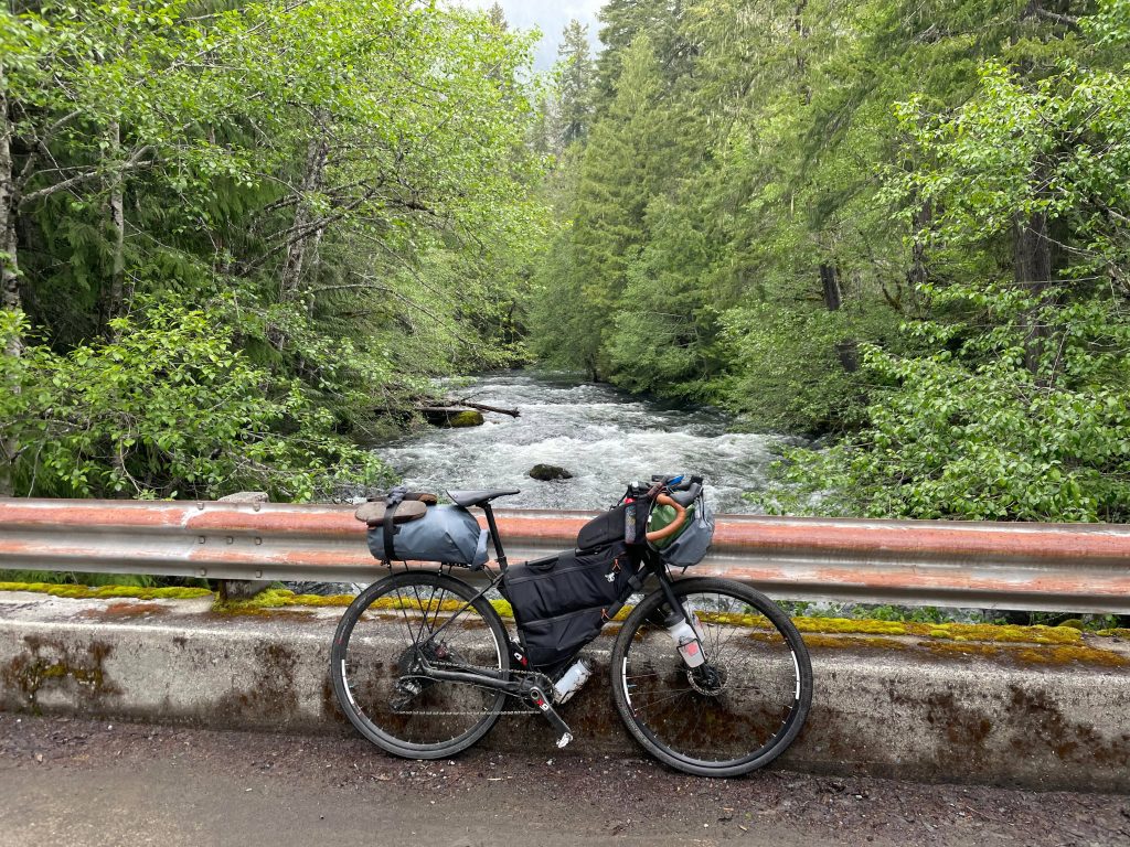
-The bike I used is a rigid 26″ inch Tout Terrain Metro with 2.3″ tires, Rohloff hub, dynamo hub, carbon drive, with TRP mechanical brakes. Front suspension would have been nice but wouldn’t say it is necessary.
Navigation:
-Download maps.me (upload .kml file for offline use) and ridewithgps route click here
-I used my phone and brought two spare battery packs. Used my dynamo hub to charge battery packs
-Definitely handy to have a bike computer
Food/H20:
-Bring a filter and some AquaMira, there were some gnarly places to filter especially on the Oregon Outback.
-Recommend carrying up to 3-4L of water, season dependent. Eastern Oregon will have sparse water so carry more during this stretch
-Stretches with limited food resupply (2-3 days). I almost always carried 4 days worth of food.
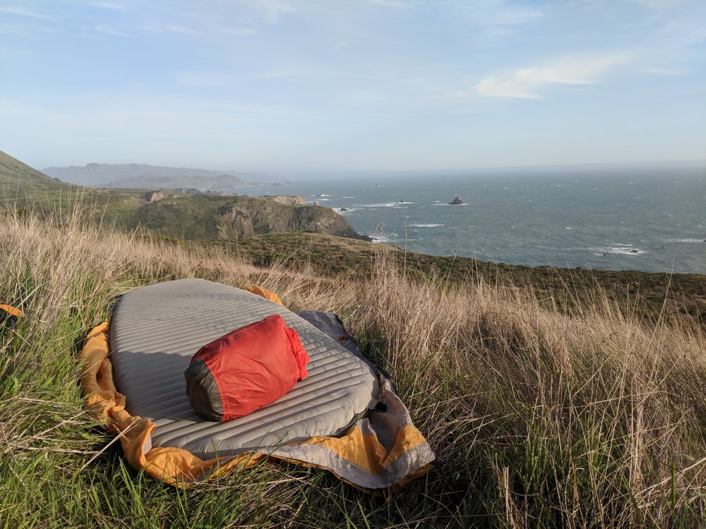
Camping:
-No problem stealth camping throughout the whole trip. Please remember your LNT Principles!
-Plenty of developed campsites along the Coast and wilderness areas
-Warmshowers.org for finding hosts in bigger towns
Unknown Sections
-Mile 1517-1600: Detoured to Santa Cruz to meet up with friends (Took Highway 1 down)
-Routed from Mile 1787 to Highway 1 because of Rohloff Shifter mechanical problems. I took highway 1 the rest of the way down to LA (bummer)
Review
In 2023, a fella named Sam reached out to me on a facebook group and told me about his time on the WCIBR
“Getting out of Seattle was a bit of a slog, but once I hit Eatonville things started to feel better and a bit more remote. The section past Mt. Adams was sick, some of the most beautiful mountain roads I’ve ever been on. I did it near the end of June, so I ran into about 3 miles of snow hike a bike unexpectedly. I was planning on camping up there but obviously decided not to.
Trout lake to Carson was also gorgeous and mostly trending downhill. Some more snow on those national forest roads, but that was fine. That stretch by the Columbia river was so terrible, almost no shoulder and cars passing by at 60 mph. I made it to the deschutes campground right around dusk in time to take my first shower of the trip and meet some people who finished the outback that day! The whole Oregon Outback route was a blast, and I kinda liked running into people doing it the other direction. There were definitely a few really cold, wet nights.
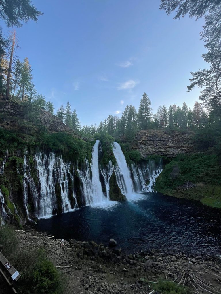
Views of mt. Shasta were unmatched from those dirt roads. Burney falls was beautiful, and I shared a campground with some PCT backpackers who had good stories. The 75 miles before and after Redding were so fucking hot, and the climbs after Redding were brutal. Once it switched away from a more deserty landscape it became way better.
This trip was my first time visiting the redwoods! They totally blew my mind. Really everything I hoped for. The Lost Coast portion was definitely a highlight, even if the “roads” were easily the toughest of the entire route. Riding the PCH made me glad I didn’t tour it the whole way. Super narrow roads and inconsiderate drivers. Plus it was windy and cold, and the view never changed. I enjoyed the 100 or so miles I did before heading inland. I basically just straight-shotted it to San Francisco after that because I had to catch a flight. I’m sure I would’ve liked the hilly off-road stuff on the coast more than the urban segment I did though.”